OceanSAMP GIS Data Download: Bathymetry
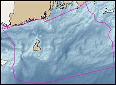
Coastal Bathymetry
These data were pulled from the NOAA Coastal Relief Model, Volume 1. This Coastal Relief Gridded database provides the first comprehensive view of the US Coastal Zone.
Metadata Raster