|
OceanSAMP GIS Data Download: Marine Boundaries |
|||
 |
1
Kilometer Land Buffer A 1km buffer of the RI coast. One of the "nobuild" criteria for the Tier 1 analysis. |

|
|
 Metadata |
 Shapefile |
||
 |
ENC
Regulated Areas Regulated areas displayed on NOAA nautical charts. One of the "nobuild" criteria for the Tier 1 analysis. |
||
Metadata |
Shapefile |
||
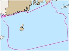 |
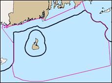
Ocean
SAMP Study Area Updated 9/2009 The Rhode Island Ocean SAMP will define use zones for Rhode Island's offshore waters through a research and planning process that integrates the best available science with open public input and involvement. |
||
Metadata |
Shapefile |
||
 |
MMS 3nmi State Waters Updated 9/2009 Extent of RI offshore waters as depicted by the Digital Offshore Cadastre, Submerged Lands Act Boundary. |
||
Metadata |
 Shapefile |
||
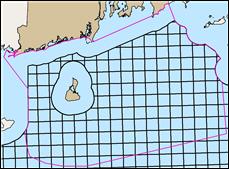 |
MMS OCS Lease Blocks Outer Continental Shelf (OCS)lease blocks are generated to define small geographic areas that identify federal land ownership and support offshore resource management. |
||
Metadata |
Shapefile |
||
 |
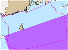
MMS Zone 8(g) The '8(g) Zone' lies between the Submerged Lands Act (SLA) boundary line and a line projected 3 nautical miles seaward of the SLA boundary line. |
||
Metadata |
Shapefile |
||
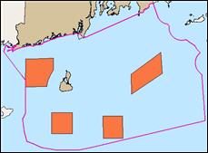 |
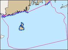
Priority
Research Areas for Geologic Study These boundaries represent areas that were designated as high priority areas for further geologic study. |
||
Metadata |
Shapefile |
||
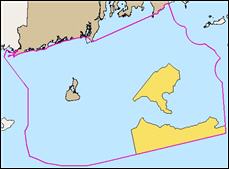 |
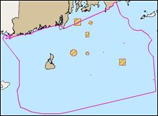
Priority
Research Areas, TDI Determined Areas that were designated by the TDI process as high priority for further research. |
||
Metadata |
Shapefile |
||
 |
Right
Whale Seasonal Management Area Seasonal restricted area for Right Whale protection as dictated by the NMFS Compliance Guide for Right Whale Ship Strike Reduction Rule. |
||
Metadata |
Shapefile |
||


