
|
OceanSAMP Fisheries Maps |
|||
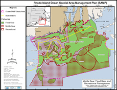 |
Combined Fishing Areas An map depicting the intersection of the fixed gear, mobile gear, and recreational fishing areas. |

|
|
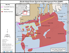 |
Fixed Gear Fishing Areas Fishing grounds used by RI commercial fixed gear fishermen. Fixed gear encompasses lobster pots, fish pots, and gill nets. |
||
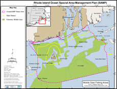 |
Mobile Gear Fishing Areas Fishing grounds used by RI commercial mobile gear fishermen. Mobile gear fisheries include trawling and scallop dredging. |
||
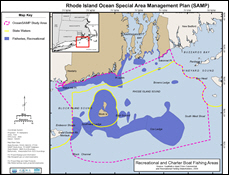 |
Recreational Fishing Areas Fishing grounds used by RI recreational fishermen. |
||
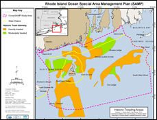 |
Historic
Trawling Intensity Historic trawl fishing grounds within Rhode Island's adjacent state and federal waters. Data are based on maps that were developed in 1972-1973. |
||
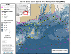 |
Fisheries Biomass Trawl Locations Scientific trawl locations conducted by the Northeast Area Monitoring and Assessment Program (NEAMAP), the National Marine Fisheries Service (NMFS), the RI Department of Environmental Management (RI DEM), and the URI Graduate School of Oceanography (GSO). |
||
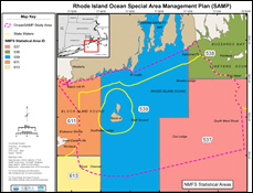 |
National Marine Fisheries Service Statistical Areas Area boundaries the National Marine Fisheries Service (NMFS) uses for calculating fisheries statistics. |
||


