|
OceanSAMP Marine Boundaries Maps |
|||
 |
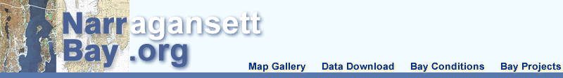
MMS
Boundaries U.S. Minerals Management Service Boundaries Extending from the Submerged Lands Act Boundary seaward to the Limit of the United States Outer Continental Shelf. |

|
|
 |
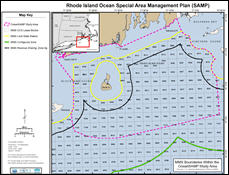
NOAA Electronic Nautical Charts (ENC) Regulated Areas ENC Designated dredge disposal sites and unexploded ordance locations. |
||
 |
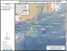
Right Whale Seasonal Management Source: NMFS Compliance Guide for Right Whale Ship Strike Reduction Rule. |
||


