
|
OceanSAMP Marine Transportation Maps |
|||
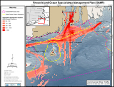 |
Commercial Vessel Traffic Automatic Identification System (AIS) vessel counts generalized to a 1km grid. |

|
|
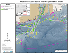 |
Ferry Transit Routes Common ferry travel routes through the SAMP study area. |
||
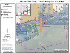 |
Naval Operating Areas Areas used by the U.S. Navy for transit and training. |
||
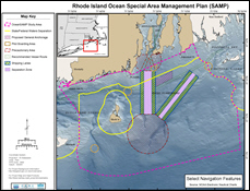 |
Select Navigation Features NOAA Electronic Nautical Chart (ENC) navigation features. |
||


